ModestR applications
 MapMaker
 DataManager
 MRFinder
 MRMapping
 Software License
 ModestR
 World freshwater data
 ModestR Updates
 Data files
 Manual & Tutorials
 Publications
 Map of visitor
 Map of visitor (no flash)
 Monthly visits
MapMaker
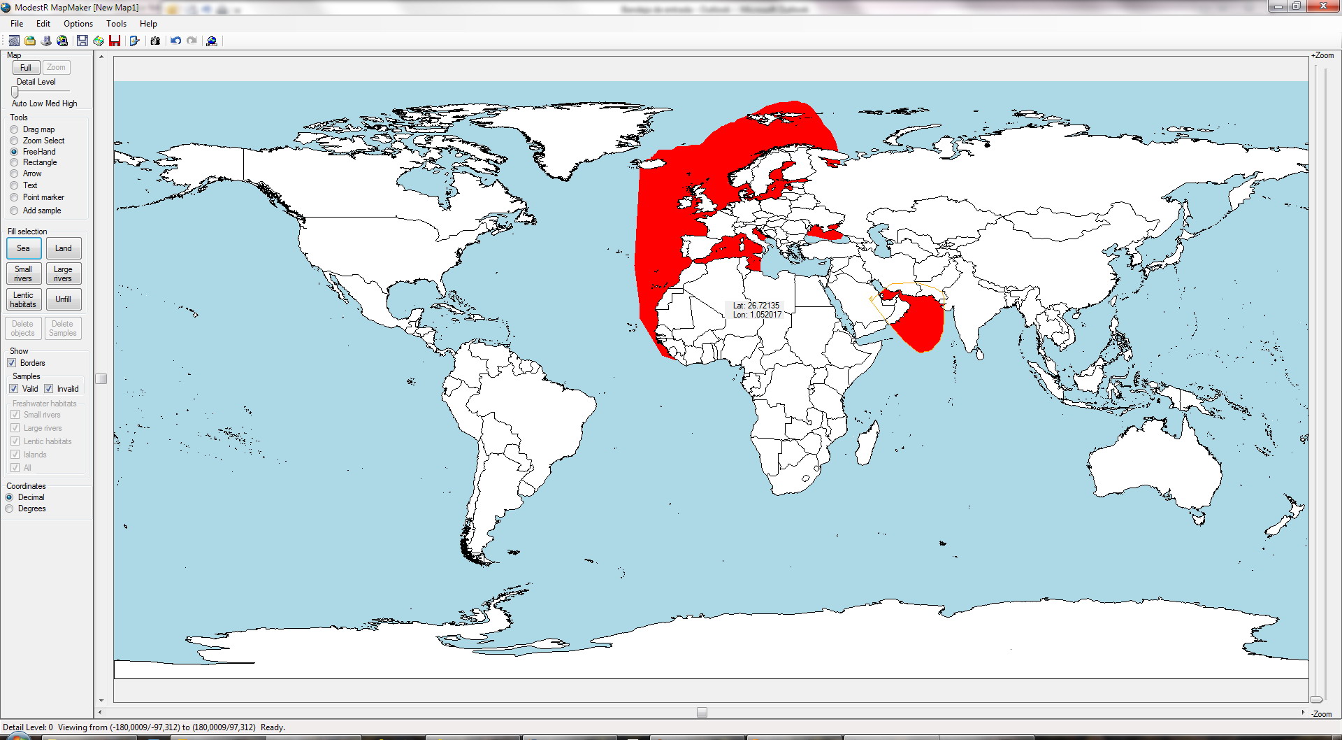
MapMaker provides an intuitive and very easy GIS-like environment to build species distribution maps. It has been designed around the concept of habitats, allowing the user to build range maps as easily as if he/she were drawing, with tools like freehand to select areas and choose which habitats of this area are occupied by a species. MapMaker will only fill the selected habitat, providing immediately a visual impression of the real areas occupied by a species. Currently more than 10 different habitats are supported: sea, land, large river areas, small river areas, lentic waters, wetlands, channels, etc.
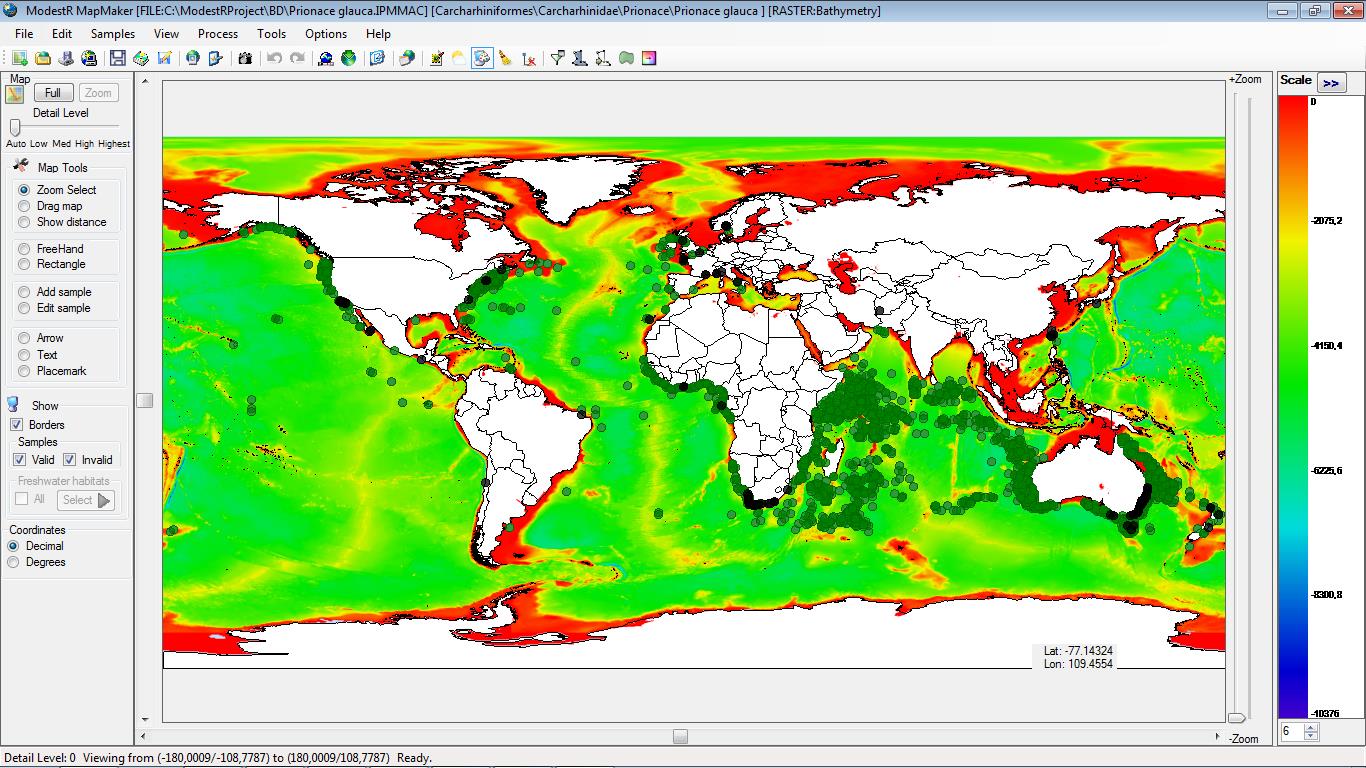
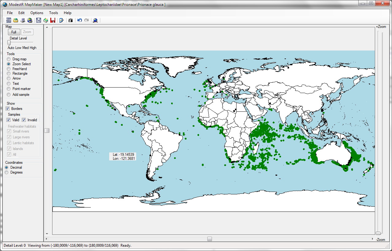
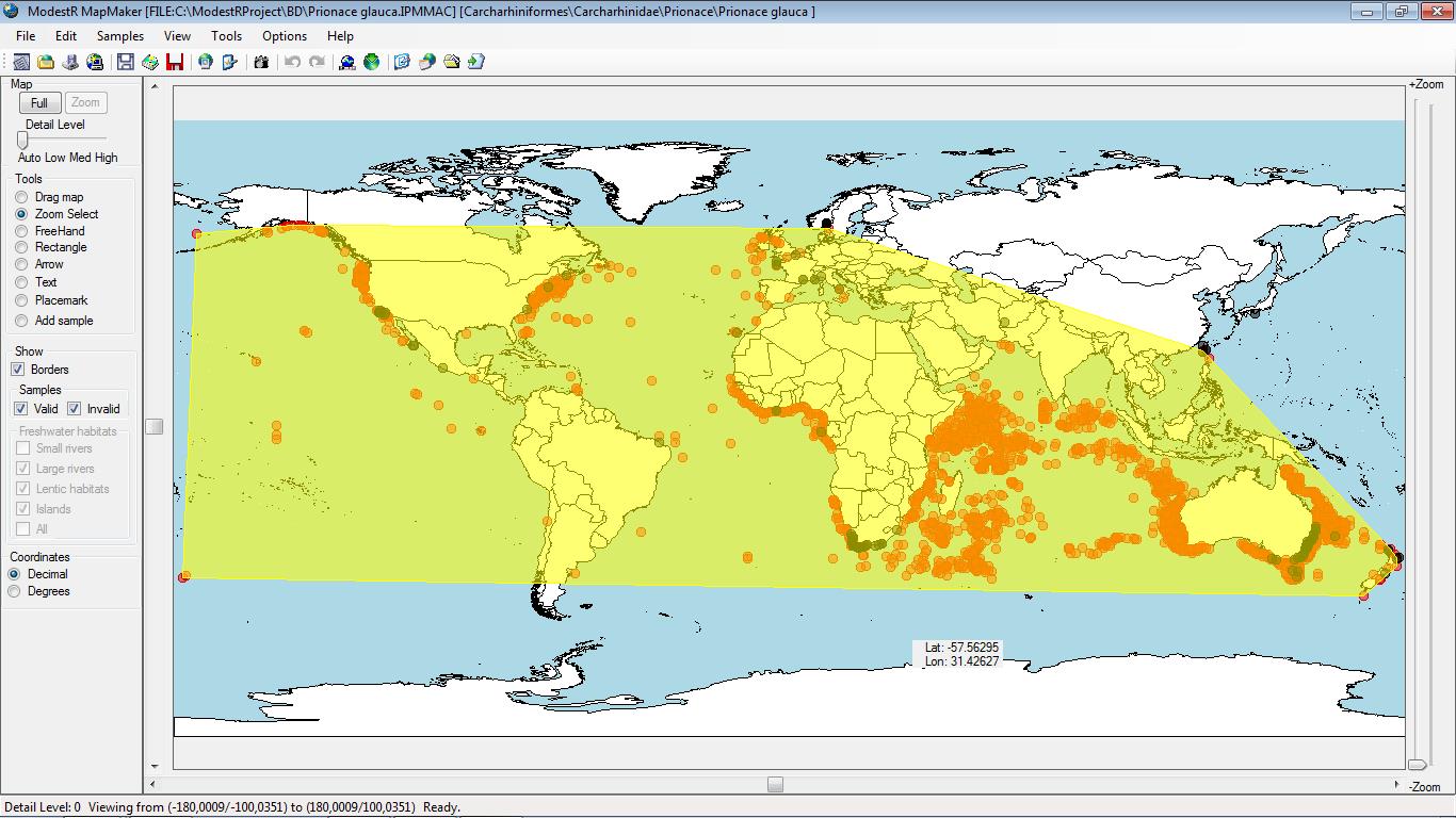
MapMaker also supports adding sample data to a map, either from CSV files or downloading it directly from GBIF database (Global Biodiversity Information Facility). To help users to clean data samples can be automatically classified by MapMaker as correct or incorrect (currently with an error of aprox. ±1 second) according to allowed habitats for the species.
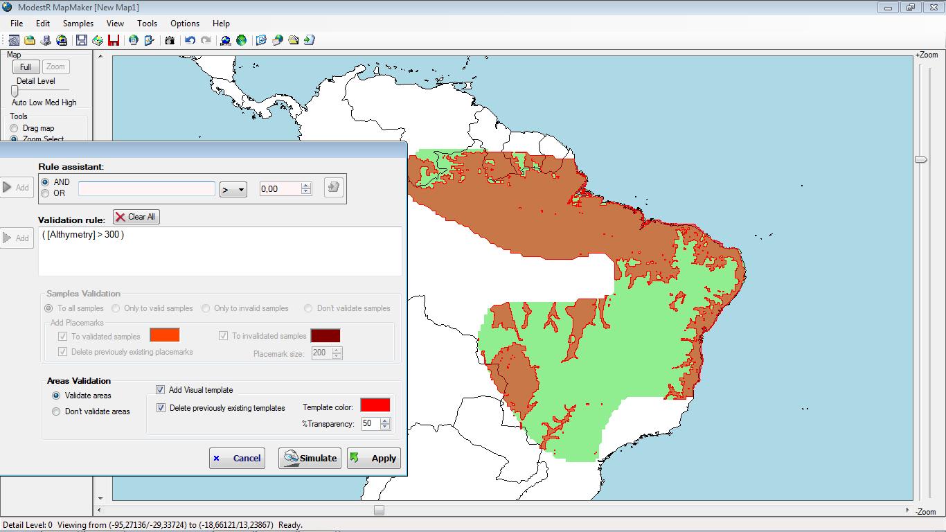
Data cleaning can be reinforced using validation rules based on environmental variables as well on sample-based maps as on expert-drawn maps (in this case environmental data has to be provided to ModestR, usually as ESRI ASCII data).
MapMaker can also calculate the hull of presence data to obtain an Extent Of Occurrence (EOO) of a species. ModestR is able to calculate AOO (Area of Occupancy) and EOO area including only the valid habitats for a species (excluding for example land area for marine species). ModestR includes three different methods to calculate hull:
1. Convex Hull
2. Alpha Shape
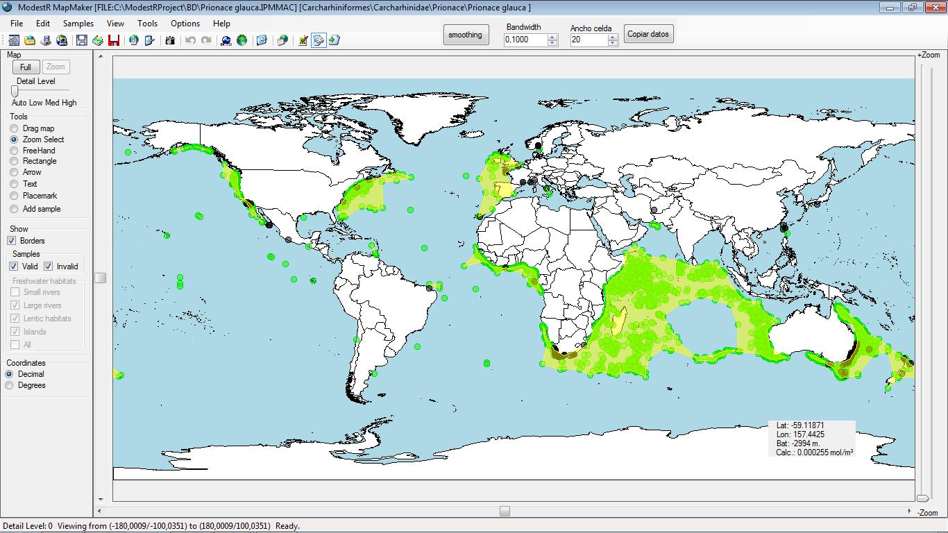
3. Density estimation
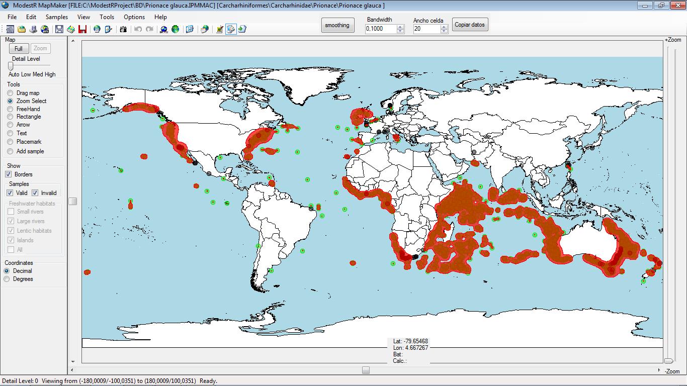
You can also perform density estimations and display very visual density maps:
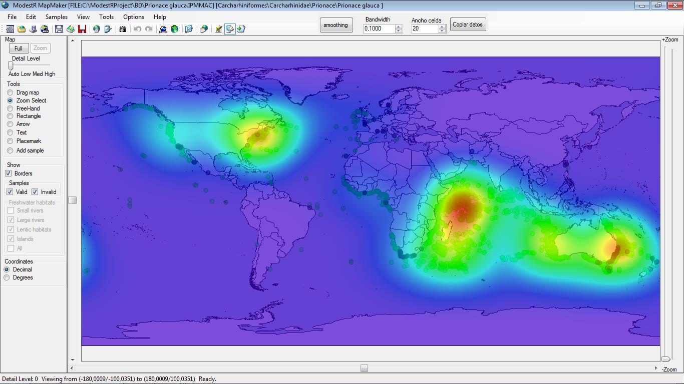
Moreover, ModestR already provides Niche of Occurrence estimation, basing on any of the previously quoted hull methods and on environmental filtering.
MapMaker maps can contain taxonomic information, and they can be directly stored in a ModestR database, which is a kind of database that can be created and managed with the DataManager application.
Finally, MapMaker can be used for presentation purposes, as it can show raster data together with presence information.